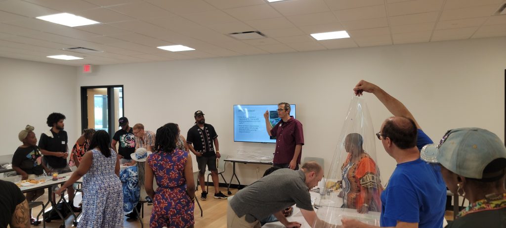
On Tuesday, June 24th, we hosted our sixth Neighborhood Power Building Project (NPP) workshop – part of the collaborative Data Justice for Pittsburgh’s Black Neighborhoods initiative between the Black Equity Coalition (BEC) and the City of Pittsburgh – at Steel City Squash in Larimer.
Together with Larimer residents, community partners, and data equity leaders, the evening began with warm welcomes, food and fellowship, followed by a recap of the last workshop on traffic calming – the practice of deliberately slowing the speed of traffic through the use of interventions such as speed bumps. The focus of this workshop was the continuation of our conversation on traffic calming and an exploration of how resident voices can be integrated into civic design through the use of tactical urbanism – an approach defined by low-cost, often modular solutions in urban design that positively affect neighborhoods while remaining responsive to community feedback.
Exploring Maps and Data: the Road Towards Safer Streets
In this meeting, members of the group engaged in a participatory mapping activity with the goal of identifying the areas in the neighborhood where community members feel like additional traffic calming improvements are needed. This activity was designed to elevate the knowledge and experiences of participants alongside administrative data, including the location of crashes reported to the state, and 311 non-emergency requests for traffic improvements made to the city.
We began by dividing participants into three groups to create their own maps. Using a large neighborhood map marked with stop signs and traffic lights, participants took some time to get oriented to the map. They personalized the map by placing stickers on the block where they live and labeled key landmarks in the neighborhood, including neighborhood assets like the Kingsley Association, churches, and the location of the meeting at Steel City Squash.
Next, we celebrated current and planned traffic calming infrastructure by placing a sticker where they were located throughout the neighborhood. These locations include:
- Larimer Ave & Shetland Street: Scheduled for curb extensions and speed tables later this year
- Meadow Street: In 2025, three speed tables and a raised crosswalk were added between Lincoln Ave. and Larimer Ave.
Lincoln Avenue & Frankstown Avenue: Bump-outs and pedestrian islands were installed in 2019, which resulted in a 15% reduction in speeding.
Principles of data justice highlight the importance of elevating local or indigenous knowledge. Participants in each of the small groups were asked to reflect and tell a story about where they feel safe or unsafe due to traffic. They, with support from the group facilitator, took notes directly on a transparency overlaid on the map itself.
We then asked participants to compare their experiences with where their neighbors made requests for traffic improvements through the city’s 311 system by overlaying data showing dots visualizing where 311 service requests had been made going back to 2016. Participants compared their experiences to where neighbors had asked the City for improvements such as enhanced enforcement, new pedestrian signals, or additional traffic calming. This led to a rich discussion about how community concerns align (or fail to align) with city response.
Next, we overlaid the locations of crashes reported to the state from a dataset from 2019–2024 on the same map. Each reported crash was represented as a pink dot where it occurred. A corresponding presentation shared details about crashes in the residential section of the neighborhood with participants, and included:
- 75% of crashes happened in clear weather and at intersections
- 57% resulted in injuries or involved aggressive driving
- 10–12% involved distracted drivers, and driving running red lights and/or stop signs
The participants compared the crash data with their own perceptions of traffic safety, and were asked to identify two intersections or blocks where improvements would make them feel safer. Each participant marked these top priorities with a sticker.
The final step for the mapping activity was to bring all of these insights into one collective map by layering all of the maps we have created throughout the evening. Seeing personal experiences, City data, and neighborhood knowledge layered together was a powerful visual – a clear roadmap for action moving forward.
Blueprints for Change: Infusing Art into Action
During the final discussion of the evening, we explored how artistic expression and tactical urbanism can come together to transform everyday streets into safer, more welcoming spaces. This portion of the workshop invited participants to imagine traffic calming not just as infrastructure, but also as art, culture, and community identity.
The concept of tactical urbanism includes short-term, low-cost, and scalable interventions that catalyze long-term change. Tactical urbanism strategies – such as asphalt art, murals, planters, street furniture, signage, and public programming – are designed to slow down traffic while celebrating the spirit of a neighborhood.
A standout case study from Pittsburgh featured an asphalt mural at a five-way intersection in Friendship, co-designed with community members. The results were striking: a 40% drop in speeding and a 61% decrease in pedestrian-vehicle conflicts. Participants were surprised that art could have such an impact on community health outcomes.
Participants also reviewed a range of creative traffic calming tools and discussed how these could be brought to Larimer. To close out the session, we held a vote to prioritize which types of art-based interventions the community was most excited to see implemented.
Looking Ahead: Paving the Way Forward
This sixth workshop was a powerful reminder of how deeply community experience and data-driven advocacy go hand in hand. In the next gathering, Larimer residents will begin working with a local artist to identify potential locations for a tactical urbanist intervention, drawing on the insights, priorities, and neighborhood knowledge shared in July. This collaborative effort will result in a resident-led improvement to the built environment, advancing neighborhood safety, public health and demonstrating the potential of community-informed action.
We would like to give a heartfelt thank you to everyone who attended – thank you for showing up, speaking up and sharing space. Your lived experiences, insight, creativity, thoughtful questions, and participation continues to fuel real, on-the-ground change! Together, we continue to build a safer, more empowered Larimer – one block at a time.
Stay tuned for updates from the next workshop at: www.BlackEquityCoalition.org.
About the Neighborhood Power Building Initiative:
The Black Equity Coalition (BEC), in partnership with the City of Pittsburgh created the Neighborhood Power Building initiative as part of the broader Data Justice for Pittsburgh’s Black Neighborhoods project, designed to empower Black residents with decision-making authority over how data is used, governed, and shared in the city. Pittsburgh is one of four U.S. cities selected for the Modern Anti-Racist Data Ecosystems (MADE) for Health Justice initiative, supported by the de Beaumont Foundation.
As a recipient of the MADE for Health Justice Grant, the BEC decided on our health equity goal: to help residents in Black communities that have been most-impacted by residential segregation and disinvestment in the City of Pittsburgh claim power to improve the quality of housing and the built environment. After a competitive RFP process, we ultimately selected the Larimer Consensus Group (LCG) as a Neighborhood Power Building Partner.